Sonobot 5 USV
Autonomous Surveys, Inspections and Monitoring


Autonomous Surveys, Inspections and Monitoring
Sonobot 5 USV
● The EvoLogics Sonobot 5 is an advanced uncrewed surface vehicle (USV) engineered for automated hydrographic surveys, infrastructure inspections, environmental monitoring or search and rescue operations in inland and coastal waters. Compact, robust, and easily deployable by a single operator, it combines professional-grade sensor technology with versatile operation modes to deliver reliable performance in diverse environments.
With its integrated systems and modular design options, Sonobot 5 is available in multiple configurations to meet mission-specific requirements. Optional add-ons, including advanced imaging, extended communication range, and real-time object recognition, expand its capabilities for complex or specialized survey scenarios.
The Sonobot 5 streamlines operations, reduces setup and handling time, and provides a professional platform for data collection and mission support – equally effective as a standalone tool or as part of a coordinated vehicle network.
With onboard AI capabilities, Sonobot 5 efficiently processes and analyzes data, enabling faster decision-making and optimized use of resources. It turns collected data into actionable insights, helping operators achieve more in less time.
Sonobot 5 USV

High-precision surveying
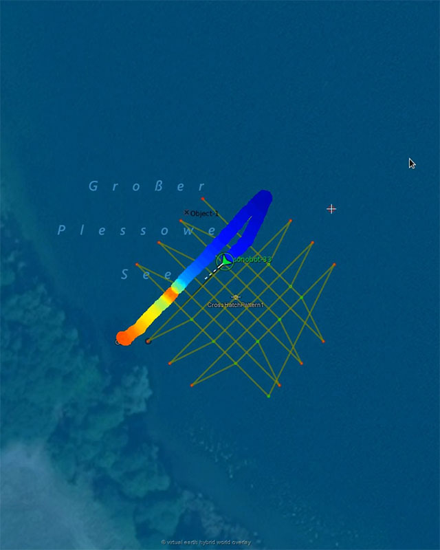
Sonobot 5 sonar options include single-beam echosounder, multibeam, side-scan and forward-looking sonars, combined with GNSS navigation and optional RTK or laser tracking for accurate bathymetry and mapping.

Compact and easy to handle
The foldable lightweight catamaran hull allows Sonobot 5 to be assembled without tools, carried by a single person, transported in a car trunk, and deployed rapidly in the field.

Stable performance and endurance
Optimized hull geometry, efficient propulsion, and swappable battery packs ensure reliable performance with up to nine hours of endurance, making the system equally suited for short deployments and longer, data-intensive missions.
Robust materials
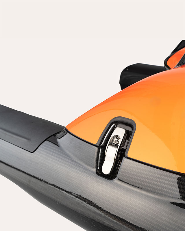
The Sonobot’s hull and components are constructed from seawater-resistant carbon fiber, stainless steel, and engineered plastics, enabling operations in both clean and contaminated waters.

Seamless communication
A redundant mesh communication network enables operation through WiFi, cellular, or long-range radio, available in multiple versions to cover the required operation range.
Versatile operation modes
The vehicle can run the mission in supervised autonomy, navigating along a pre-programmed waypoint grid with the option for operator intervention, or be manually operated using the remote control.
Flexible mission planning and data review
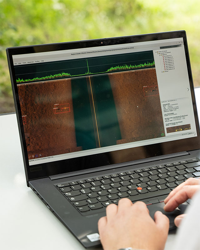
The Sonobot’s control software supports the entire mission cycle: interactive, geo-referenced planning of the survey grid with configurable sensor parameters; reliable control, track visualisation and data preview during deployment; wireless downloads of the full dataset after the mission, post-mission analysis and multi-format data export for seamless integration into existing workflows.
Sonobot 5 USV
Sonobot 5 USV
The Sonobot 5 is available in multiple configurations, from standard survey setups to advanced infrastructure inspection or diver support systems. Our experts can help you select the right combination of sensors, geopositioning and communication options to match your operational needs.
Whether in rivers, lakes, or coastal waters, the Sonobot 5 can be equipped for maximum efficiency and reliability.
Here are some sample Sonobot 5 configurations for various types of professional use:

Standard Survey Configuration
Single-beam echosounder and side-scan sonar for high-quality bathymetric mapping and seabed imaging.

High-Resolution Mapping Configuration
Multibeam sonar for detailed seabed surveys and precise 3D modeling of underwater structures.

Infrastructure Inspections Configuration
Forward-looking sonar, side-scan sonar with AI-based object recognition, underwater camera for detecting issues and documenting the findings.

Diver Navigation Support Configuration
Equipped with a USBL antenna, the Sonobot 5 acts as a mobile surface gateway for acoustic positioning networks, supporting communication with divers and AUVs.
Sonobot 5 USV
The Sonobot 5 is designed to support a wide range of operations, delivering a balance of portability, autonomy, and professional-grade sensors for diverse professional tasks:

Hydrographic and bathymetric surveys
Sonobot 5 produces high-resolution maps of rivers, lakes, reservoirs, and coastal areas, using advanced sonar systems and precise GNSS/RTK navigation for accurate bathymetry.

Infrastructure inspection and monitoring
Integrated sonar and visual payloads enable detailed assessment of bridges, dams, ports, and other critical structures, supporting maintenance and safety evaluations.
Environmental and scientific research
Modular sensors and onboard cameras allow comprehensive ecosystem monitoring and environmental data collection in rivers, lakes, and coastal areas.

Search and rescue, investigation support
AI-based object recognition, side-scan sonar, and optional thermal or stereo cameras enable real-time object localization, reducing operational time for response teams.

Hazard detection
AI-assisted modules identify dangerous underwater objects, such as mines or debris, providing support for both civil and military security operations.

Cooperative robotic missions
In USBL configuration, the vehicle acts as a mobile surface gateway for acoustic positioning networks and follows tracked assets, ensuring uninterrupted coverage and multi-vehicle coordination.
Sonobot 5 USV
Contact
Get in touch and share your project requirements – let’s put together the optimal Sonobot 5 for your operations.
All information you provide us is treated with strict confidence and stored only in relation to your request.
