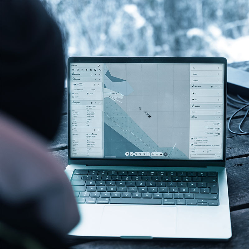
Diver Navigation System
Main Features
The Diver Navigation System combines innovative features that enhance operational flexibility, mission success, and diver safety in challenging underwater environments.
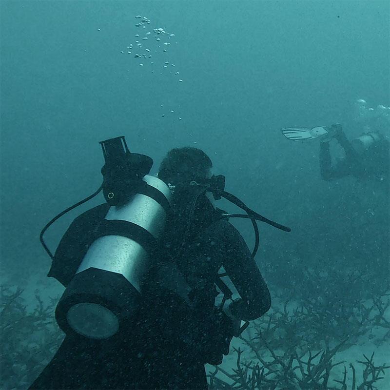
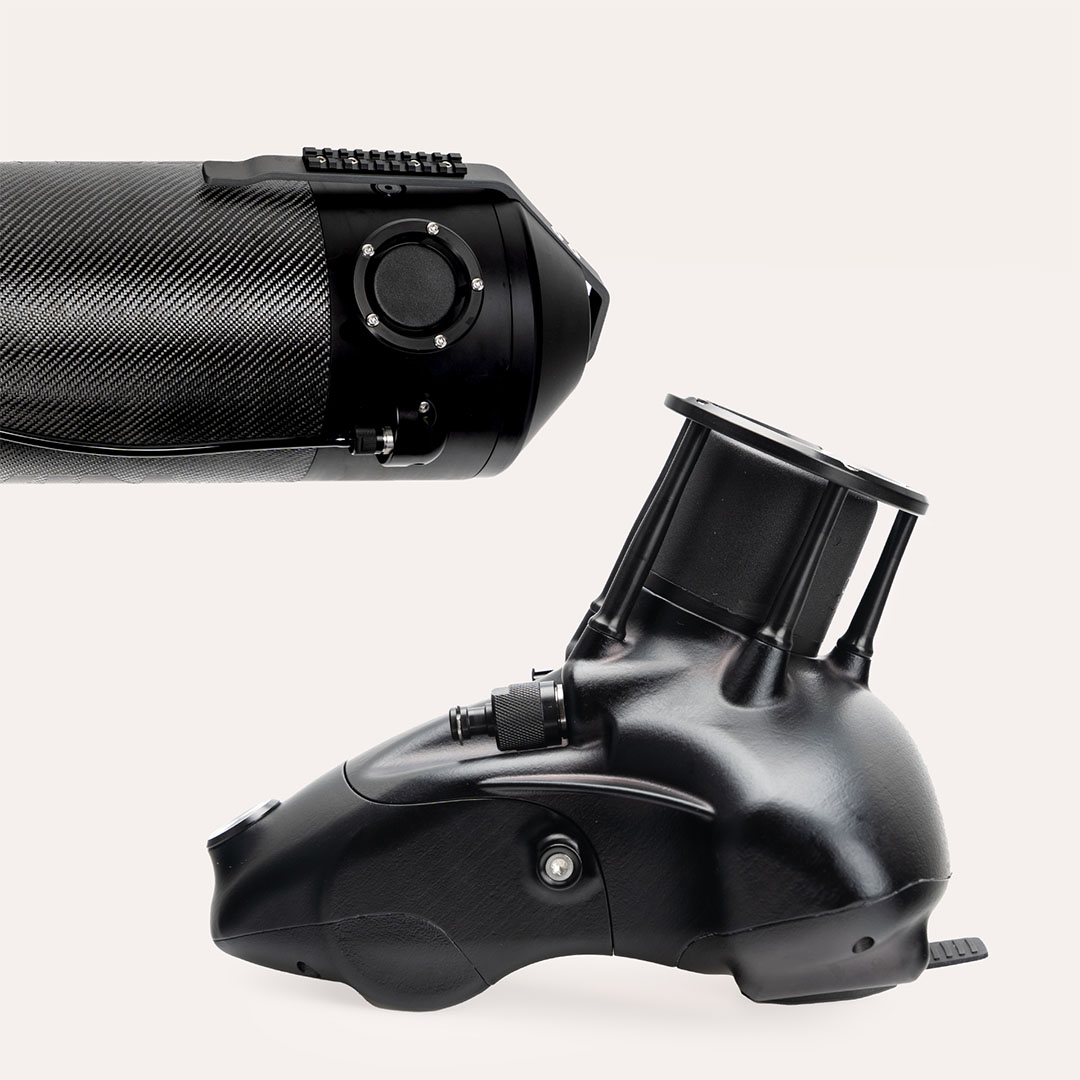
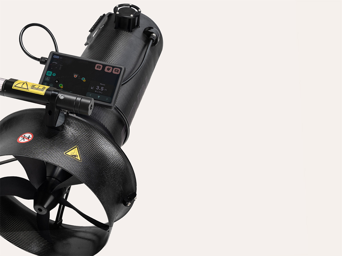
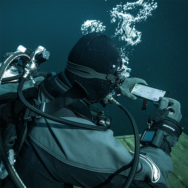
Compatible with various diving gear
Compatible with your diving equipment - tank-mounted or scooter-mounted setups enable quick deployment with compact, diver-friendly hardware for maximum comfort and mobility.
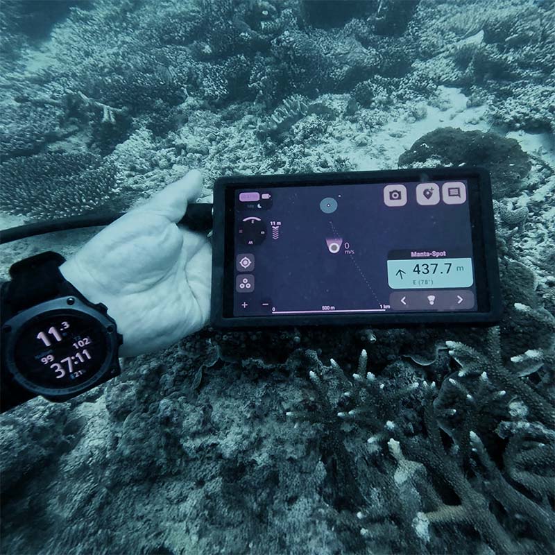
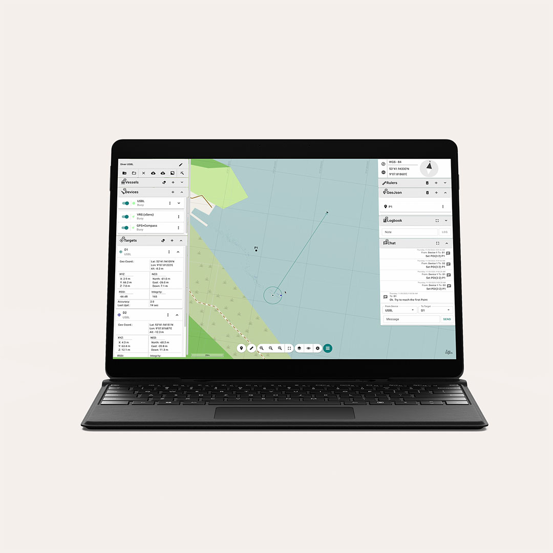
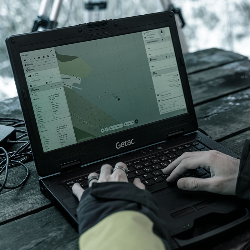
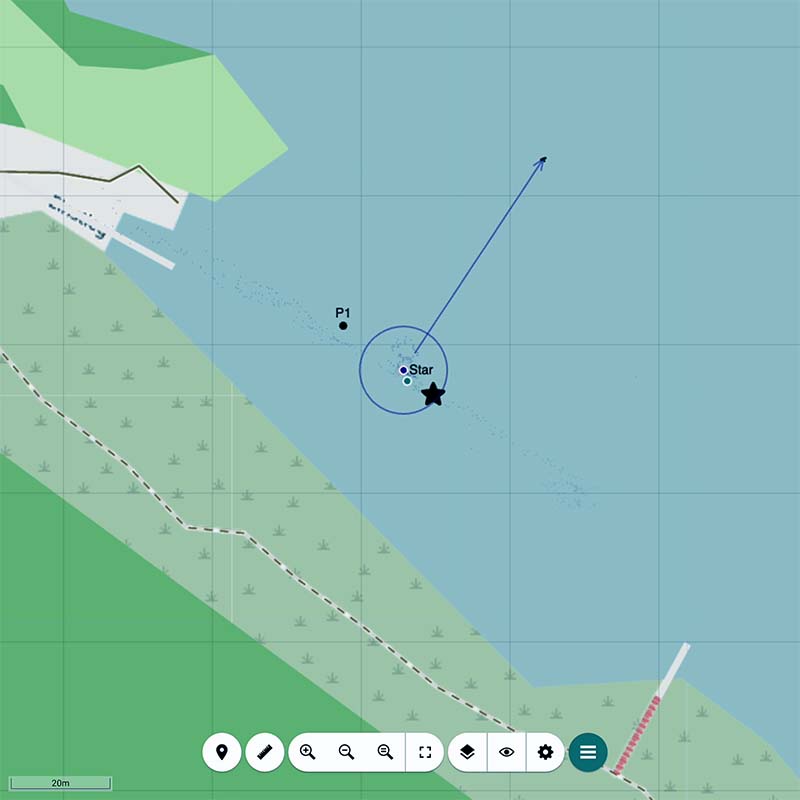
Geo-referenced missions
Set, receive, and share points of interest in absolute geo-coordinates - before or during the mission - and efficiently guide your team through complex underwater environments. Divers can mark points of interest underwater and instantly share them with teammates and the surface crew, ensuring real-time coordination that improves the mission’s outcome.
Real-time position tracking
Continuously track your team with real-time diver positioning, providing accurate updates so surface crews have full situational awareness, helping you manage missions effectively and keep divers safe using EvoLogics’ proven S2C underwater communication protocol.
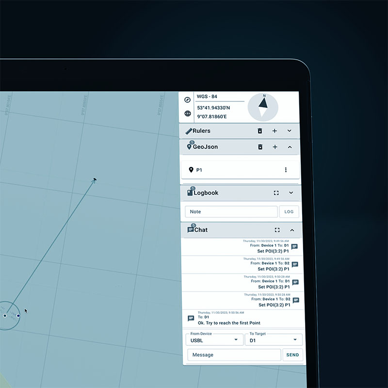
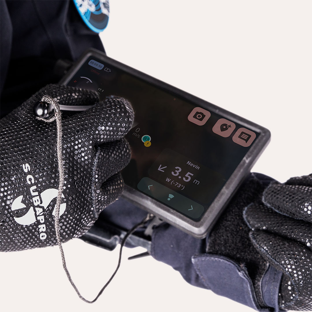
Two-way text communication
Stay connected with reliable two-way text messaging that keeps you in touch with dive supervision teams and other divers: exchange mission updates, instructions, points of interest and task changes in real time, amplifying both safety and teamwork.

Visual documentation
Capture and share photos during the mission to provide real-time visual documentation of points of interest or important findings.
Mission review and analysis
All mission data, including interactions, photos, and observations, is recorded for comprehensive review, post-mission analysis, and easy export for reporting or follow-up planning.